NWS Cheyenne: Winds Will Ramp Back Up as Cold Relents
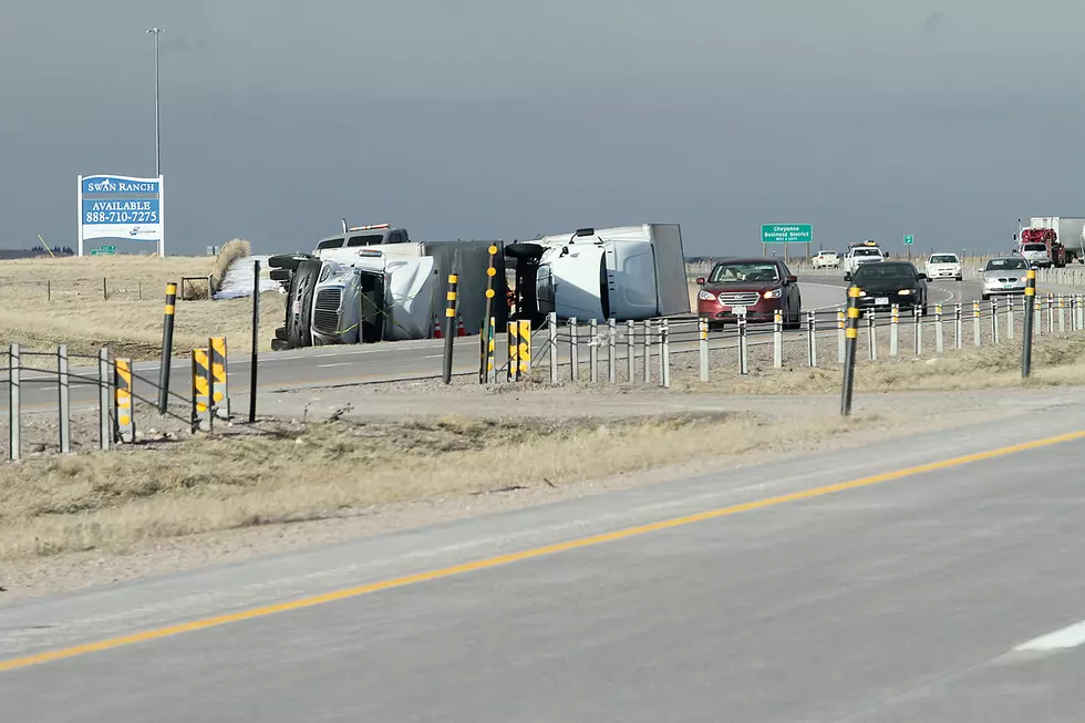
Parts of Interstate 80 in southeast Wyoming, including the Summit, could see wind gusts up to 60 mph this weekend, according to the National Weather Service in Cheyenne.
"A warming trend will begin this weekend, but winds could be on the increase too," the NWS said.
High Wind Watches are in effect for the north Snowy Range foothills and the south Laramie Range from Friday evening through Saturday afternoon.
URGENT - WEATHER MESSAGE
National Weather Service Cheyenne WY
200 PM MST Thu Feb 24 2022

WYZ110-251200-
/O.NEW.KCYS.HW.A.0020.220226T0600Z-220226T2100Z/
North Snowy Range Foothills-
Including the cities of Arlington and Elk Mountain
200 PM MST Thu Feb 24 2022

...HIGH WIND WATCH IN EFFECT FROM FRIDAY EVENING THROUGH SATURDAY
AFTERNOON...

* WHAT...West winds 25 to 35 mph with gusts up to 60 mph possible.

* WHERE...North Snowy Range Foothills including Interstate 80 near
  Arlington and Elk Mountain.

* WHEN...From Friday evening through Saturday afternoon.

* IMPACTS...Mainly to transportation. Strong cross winds may be
  hazardous to light weight and high profile vehicles, including
  campers and tractor trailers, with a risk for blow overs.

PRECAUTIONARY/PREPAREDNESS ACTIONS...

A High Wind Watch means there is the potential for a hazardous
high wind event. Sustained winds of at least 40 mph, or gusts of
58 mph or stronger may occur. Continue to monitor the latest
forecasts.
URGENT - WEATHER MESSAGE
National Weather Service Cheyenne WY
200 PM MST Thu Feb 24 2022

WYZ116-251200-
/O.NEW.KCYS.HW.A.0020.220226T0900Z-220226T2100Z/
South Laramie Range-
Including the cities of Buford, Pumpkin Vine, and Vedauwoo
200 PM MST Thu Feb 24 2022

...HIGH WIND WATCH IN EFFECT FROM LATE FRIDAY NIGHT THROUGH
SATURDAY AFTERNOON...

* WHAT...West winds 25 to 35 mph with gusts up to 60 mph possible.

* WHERE...South Laramie Range including the Interstate 80 Summit.

* WHEN...From late Friday night through Saturday afternoon.

* IMPACTS...Mainly to transportation. Strong cross winds may be
  hazardous to light weight and high profile vehicles, including
  campers and tractor trailers, with a risk for blow overs.

PRECAUTIONARY/PREPAREDNESS ACTIONS...

A High Wind Watch means there is the potential for a hazardous
high wind event. Sustained winds of at least 40 mph, or gusts of
58 mph or stronger may occur. Continue to monitor the latest
forecasts.

Get our free mobile app
weather.gov/cys
3PM 2/24 – As the cold relents, the wind returns of course! A warming trend will begin this weekend, but winds could be on the increase too. A High Wind Watch has been issued for the wind prone corridors of SE Wyoming from Friday evening through Saturday afternoon.
KEEP READING: Get answers to 51 of the most frequently asked weather questions...
More From Wake Up Wyoming


