Parts of Southeast Wyoming Could See 90 MPH Wind Gusts Monday
Wind gusts in excess of 65 mph are expected to blast a large portion of southeast Wyoming late tonight through late Monday.
The National Weather Service in Cheyenne issued the following statements early Sunday morning:
30/240AM: Greetings! Winds will be on the increase through late tonight into Monday. Very strong winds return to Arlington, Bordeaux, and I-80 Summit areas on Monday. High Wind Warnings are now in effect for the Arlington, Bordeaux, I-80 Summit, Southern Foothills, and North Laramie Range area from late tonight through late Monday evening. Winds will increase in the Arlington area first late tonight, and spread into other areas on Monday. Gusts up to 65-90 mph are likely in these areas, especially the North and Central Laramie Range/Bordeaux areas. Strongest winds look to occur between approximately 11AM-6PM Monday. A High Wind Watch has been issued for additional areas across Southeast Wyoming mainly east of I-25 for Monday. Wind gusts up to 60-65mph will be possible. There will be a EXTREME blowoff/blow over risk for light weight and high profile vehicles, including those towing camper trailers. For road conditions, refer to www.wyoroad.info. For the most up-to-date weather forecast, refer to weather.gov/CYS

630 AM 01/30/2022 – Pockets of elevated fire weather danger will be possible on Monday in portions of the Nebraska Panhandle and parts of the North Platte Valley into Goshen County where no snow remains. Monday will be well above normal temperature wise with winds of 30 to 45+mph in the areas of lowest humidity dropping into the low teen percentiles. Despite recent snow a couple weeks ago, most of it has sublimated into the atmosphere vs. adding to soil moisture. Grass fuels remain dry and cured and could potentially carry fire if an ignition source occurred. There is the potential for any new fires to spread quickly in fast burning fuels, like grasses, on Monday with the higher winds. Burning of any kind is STRONGLY discouraged on Monday! See weather.gov/cys for more information today and Monday.
READ MORE:
- One Year Ago Today: Cheyenne Records 89 MPH Wind Gust
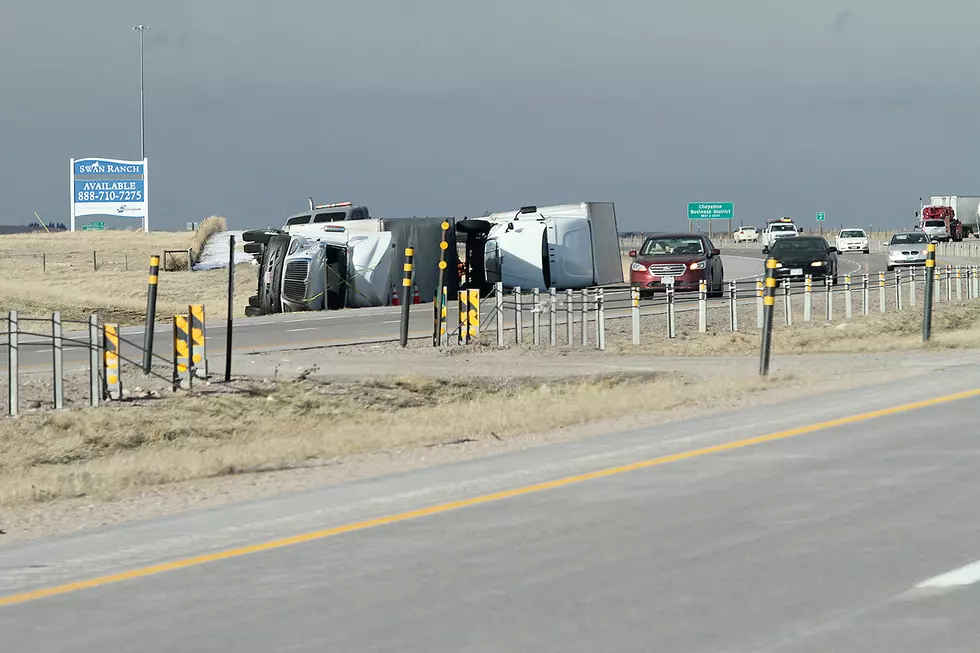
- WATCH: Brutal Wind Topples Semi on I-25 South of Cheyenne
TIPS: Here's how you can prepare for power outages
LOOK: The most expensive weather and climate disasters in recent decades
Gallery Credit: KATELYN LEBOFF
More From Wake Up Wyoming