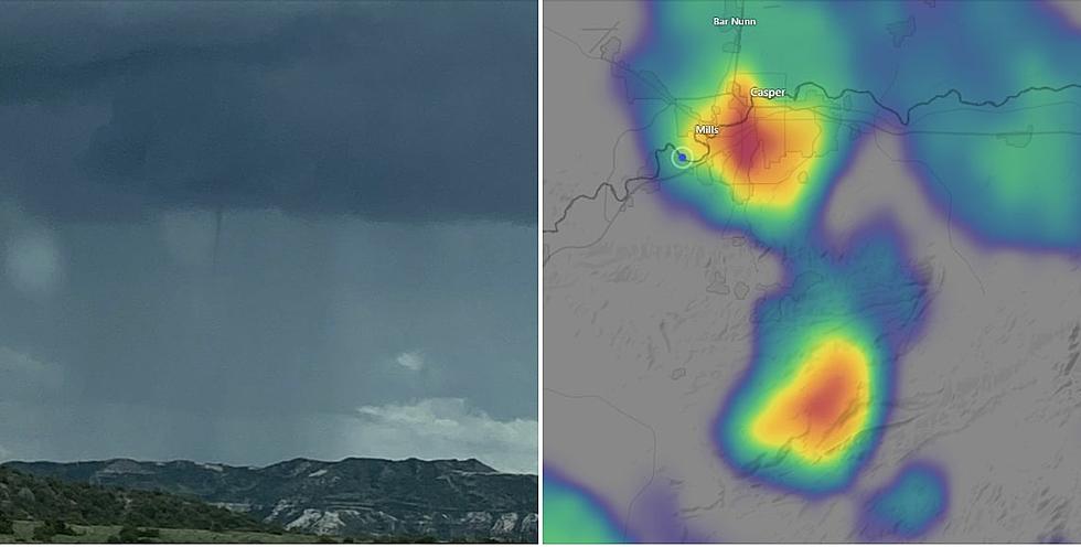
National Weather Service Reports Cold Air Funnels in Natrona County
Natrona County Emergency Management has received numerous calls about cold air funnels south of Casper Mountain on Thursday.
The Riverton office of the National Weather Service also has reported the funnels, according to a press release from County Emergency Management.
Cold Air Funnels form beneath showers or weak thunderstorms when the air aloft is especially cold.
The funnels are most common in the fall and spring when the sun is able to heat the lower levels of the atmosphere, causing convection to bubble up and form showers.
Temperatures around 15,000 feet to 20,000 feet above the ground are quite cold.
Cold Air Funnels are usually harmless, but on rare occasions they can touch down.
The National Weather Service also says a strong thunderstorm will impact portions of southeastern Natrona County through 3 p.m.
At 2:31 p.m., Doppler radar was tracking a strong thunderstorm near
Beartrap Meadows County Park, about 10 miles south of Casper, and
moving north at 10 mph.
The storm could bring winds in excess of 30 mph, half-inch hail and gusty winds.
Other locations in the path of this storm include the south side of Casper, Evansville, Red Butte, and Paradise Valley.
This includes Interstate 25 between mile markers 181 and 185.
The storm could cause localized flooding. Do not drive vehicles through flooded
roadways.
Likewise, frequent cloud to ground lightning is occurring with this storm.
Wyoming Weed & Pest's Most Notorious Species
*Photo of Cold Air Funnel this afternoon in the area of MP 56 on HWY 487, Natrona County
More From Wake Up Wyoming