UPDATE: Mullen Fire at 2% Containment, Evacuations in Albany County
UPDATE: Sep 21, 2020 @ 7:30 PM
As of early Monday evening, The Mullen Fire has grown to 13,504 acres with 2% containment the Forest Service said. They added that when the fire came out of wilderness areas it slowed down some and that there has been some success in containing the fire on its west side.
- The Lake Creek community has been evacuated by Albany County.
- Additional evacuations include Rambler, Rob Roy, & Keystone. Keystone area includes Keystone proper, lower Keystone, Langford/Ricker, Moore's Gulch, & 507C cabin grouping
- Albany Co. EMA also issued a pre-evacuation notice for the Centennial Valley on Sunday. This area includes private land along Fox Creek Road, the communities of Albany, Centennial, extending North West to the Snowy Range along highway 130, and all areas west of Highway 11 in the valley.
UPDATE: Sep 20, 2020 @ 5:00 PM
The speed and growth of the Mullen Fire in Medicine Bow National Forest has prompted the call to evacuate the Keystone, WY area. The Centennial Valley area has been asked to prepare for potential evacuations.
Statement from the US Forest Service:
For Immediate Release from Albany County, Sun. 9/20/20, 2 pm
Evacuation for Keystone:
The Mullen Fire is rapidly approaching the Keystone area. Albany County Emergency Management Agency has requested the evacuation of the area to better allow for fire support to focus on mitigation. If you need assistance with evacuations, please dial 911 to request support. Please refer to Albany County website for general information related to non-emergency questions.
Pre-Evacuation of Centennial Valley:
Due to strong winds and the movement of the Mullen Fire, Albany County Emergency Management Agency (EMA) has requested the Centennial Valley to prepare for potential evacuations. This area includes private land along Fox Creek Road, the communities of Albany, Centennial, extending North West to the Snowy Range along highway 130, and all areas west of Highway 11 in the valley. Please be prepared to leave immediately if an evacuation order is called for.
Albany Co. Emergency Mgmt: https://www.co.albany.wy.us/228/Emergency-Management-Agency-Homeland-Sec
UPDATE: Sep 20, 2020 @ 12:00 PM
As of late Sunday morning, The Mullen Fire burning in Medicine Bow National Forest had grown to 13,835 acres and The Forest Service says that it is expected to continue growing. A large closer area is in effect and all people, including campers and hunters, should leave the area.
The fire is reportedly close to the Rob Roy Reservoir. Planes and helicopters continue to drop retardant in the Rambler area of the fire. The fire remains intense and evolving with strong and gusty winds expected to continue Sunday. The Rambler and Rob Roy areas have been evacuated and The Keystone area is under pre-evacuation notice.
Incident Overview from the US Forest Service - 10:30 AM September 20
- Acreage is reported at 13,835 following assessment flights over the fire this morning
- Please take note of & respect the enlarged area closure
- Fire growth yesterday was NE, N, & S
- There were rain showers on parts of the fire last night
- Weather forecast is for cooler weather today, but still strong & gusty winds
- This remains a rapidly changing & developing situation, with focus on public & firefighter safety
- The fire has crossed the Savage Run Wilderness boundary on the south flank, as well as the 512 Rd
- In addition to the Savage Run Wilderness, the fire is now established in the Platte River Wilderness
- There is intense fire activity on multiple flanks
- Ground crews & helicopters have been successful at checking growth to the W in lighter fuels
- It is aligning with slope/wind/fuels & moving as predicted
- There are minimal natural fuel breaks most directions the fire is growing
- Possibility for extreme fire behavior exists through the weekend
- Helicopters, air tankers, & single-engine air tankers are working the fire edges
UPDATE: Sep 19, 2020 @ 9:47 PM
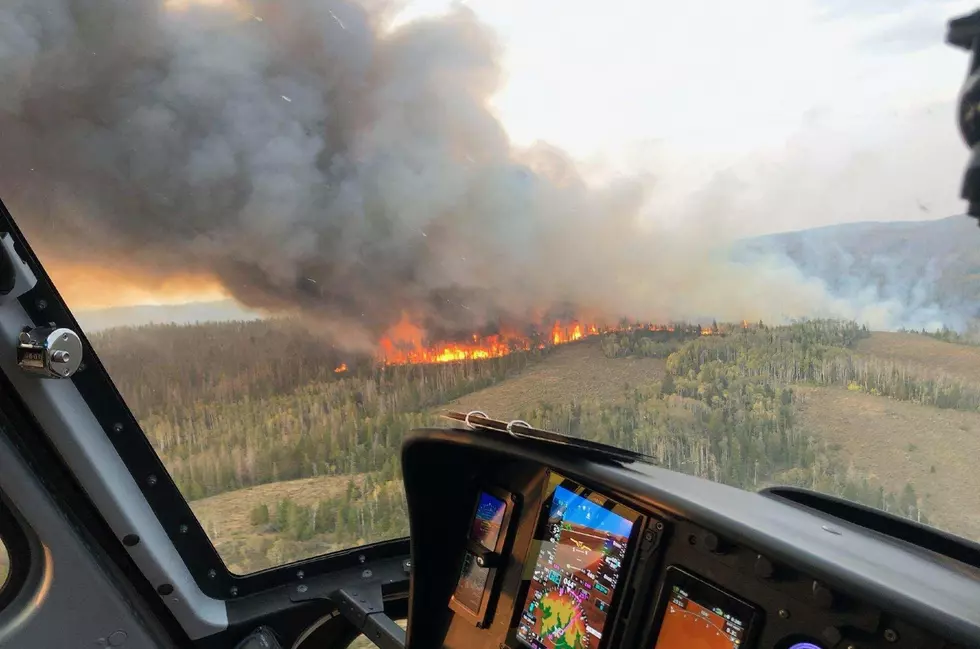
The Mullen Fire's closure area has been expanded (see map below or click here) as strong and shifting winds force crews to pull for the evening. Aerial crews were grounded because of the winds and visibility issues. The Forest Service says that the "[l]ast reported acreage was approximately 7,000, but it is likely much larger."
The fire has established itself in the Platte River Wilderness according to The Forest Service, "There is intense fire activity on multiple flanks."
This remains a rapidly changing & developing situation, with a focus on public & firefighter safety
Incident Overview from the US Forest Service - 8 PM September 19
- Due to strong & shifting winds this afternoon/evening, resources had to be pulled back from the fire for safety reasons
- Aerial resources were also pulled off the fire due to erratic winds & limited visibility from smoke
- There will be no acreage update this evening
- Last reported acreage was approximately 7,000, but it is likely much larger
- The National Forest area closure has been expanded N, E, and S
- 10+ aircraft, including a VLAT & multiple LATs, were assigned to the fire today
- Additional information will be updated on this site as it becomes available
- This remains a rapidly changing & developing situation, with focus on public & firefighter safety
- The fire has crossed the Savage Run Wilderness boundary on the south flank, as well as the 512 Rd
- Fire is now established in the Platte River Wilderness
- On the east side, the fire has crossed the Savage Run Wilderness boundary over the 511 Rd, near Forest Road 562
- There is intense fire activity on multiple flanks
- Ground crews & helicopters have been successful at checking growth to the W in lighter fuels
- Rambler, & Rob Roy areas have been evacuated
- The Keystone area is under pre-evacuation notice. This includes Keystone proper, lower Keystone, Langford/Ricker, Moore's Gulch, & 507C cabin grouping
- It is aligning with slope/wind/fuels & moving mainly east, NE, & SE
- There are minimal natural fuel breaks most directions the fire is growing
- All public, including campers & hunters, should leave the area
- Possibility for extreme fire behavior exists through the weekend
- There is a high probability for fire growth up the Mullen Creek drainages
- Assessment for protection of private property at risk is occurring
- Forest Service staff, Wyoming Game & Fish, and Albany/Carbon Counties have evacuated people from the fire area
- Helicopters & single-engine air tankers are working the fire edges
- Fire origin is in Savage Run Wilderness, Medicine Bow National Forest, Carbon County
- Cause unknown at this time
- Reported mid-day Thurs., Sept. 17
- Extremely rugged terrain, with live blowdown & beetle-killed deadfall
- Coordination is taking place with both Carbon & Albany Counties, Wyoming Game & Fish, & Cheyenne Board of Public Utilities
- Initially called Savage Run Fire
Sep 19, 2020 @ 6:25
Mullen Fire Grows to 7000 Acres Saturday, Aircraft Added to Fight
The Mullen Fire grew to about 7000 acres by late Saturday afternoon (September 19). Several aircraft are now fighting the blaze. The Forest Service says that the crafts are dropping retardant and water to protect the Rambler subdivision near Rob Roy Reservoir. The fire is burning in Medicine Bow National Forest about 50 miles west of Laramie, Wyoming.
The unincorporated Albany County town of Keystone is under pre-evacuation notice. This includes Keystone proper, lower Keystone, Langford/Ricker, Moore's Gulch, and 507C cabin grouping. The Rambler and Rob Roy areas have been evacuated.
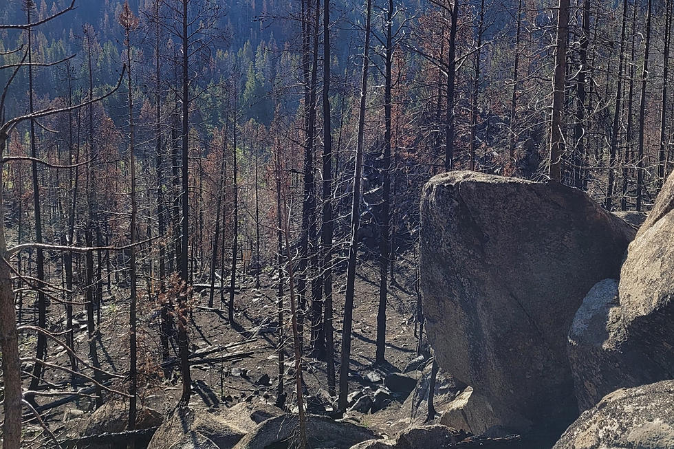
The fire started in the Savage Run Wilderness of Medicine Bow National Forest in Carbon County, Wyoming, and was first reported on Thursday (September 17). The cause is so far unknown. The Forest Service says that the fire is located in "extremely rugged terrain," and is burning beetle-killed and downed lodgepole pine.

4 Of Wyoming's Worst Wildfires
More From Wake Up Wyoming