VIEW: Wyoming Drought & Fire Danger Maps
This past winter, a high-pressure system that usually parks itself more to the west, under Alaska, slid down more to the southeast than it usually does. This bent the jet stream around Wyoming and other western states. While the rest of the northern hemisphere suffered through a brutally cold and snowy winter, it simply went around states parked under it.
This has not been the first time such a weather event has happened out west, but it is rare.
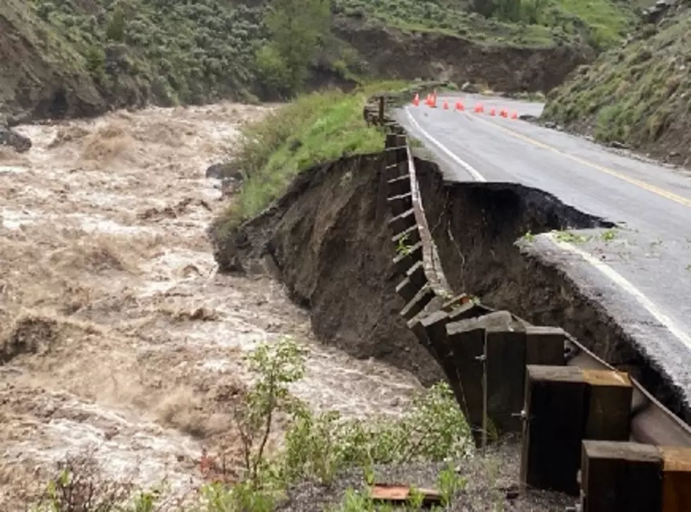
A dry winter and a dry spring mean high fire danger in the mountains and plains.
The U.S. Drought Monitor depicts the location and intensity of drought across the country. The map uses 5 classifications: Abnormally Dry (D0), showing areas that may be going into or are coming out of drought, and four levels of drought (D1–D4).
The map below is jointly produced by the National Oceanic and Atmospheric Administration, U.S. Department of Agriculture, National Aeronautics and Space Administration, and National Drought Mitigation Center.

You can view this map here, but it is interactive if you click this link and go to the U.S. Drought Monitor site.
Wyoming has a fire restrictions map at this link.
Authors from these agencies rotate creating the map each week, using both physical indicators and input from local observers.
This map is used by the U.S. Department of Agriculture to trigger some disaster declarations and loan eligibility. Individual states and water supply planning may use additional information to inform their declarations and actions.
Penny's Diner At Bill Wyoming
Gallery Credit: Glenn Woods
Jay Em, Wyoming, Frozen In Time
Gallery Credit: Glenn Woods
More From Wake Up Wyoming